Author: Lou Rawcliffe 08/09/2019
Walking time approximately 1½ to 2 hours.
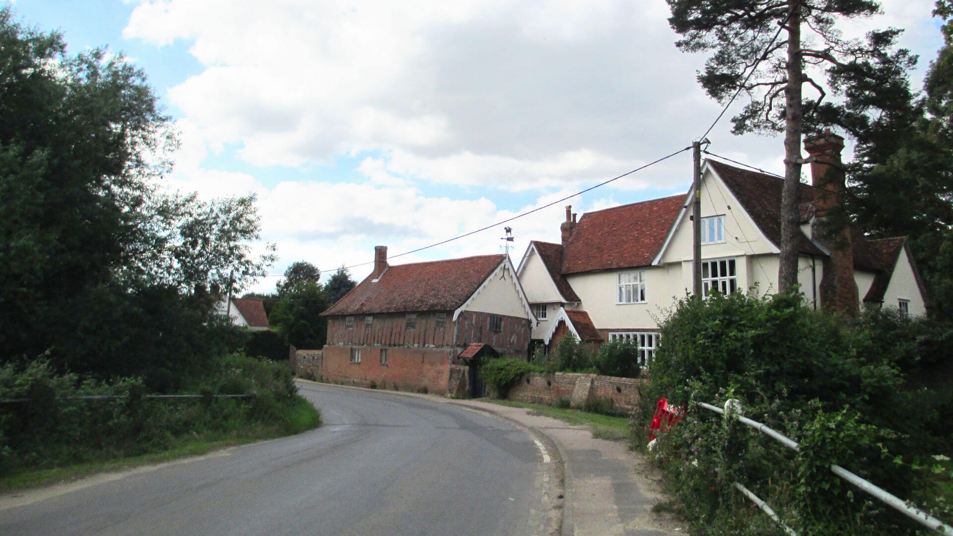
A pleasant 4-5 mile walk from the village of Somersham, with typical Suffolk vistas of open fields and ancient churches, finishing at the community-owned Duke of Marlborough pub.
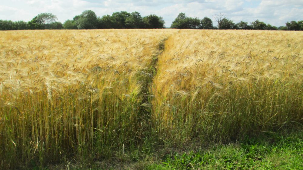
Some gentle hills (nothing too steep), mostly good paths but some uneven ground. Crops in fields in Summer. May be muddy in wet weather.
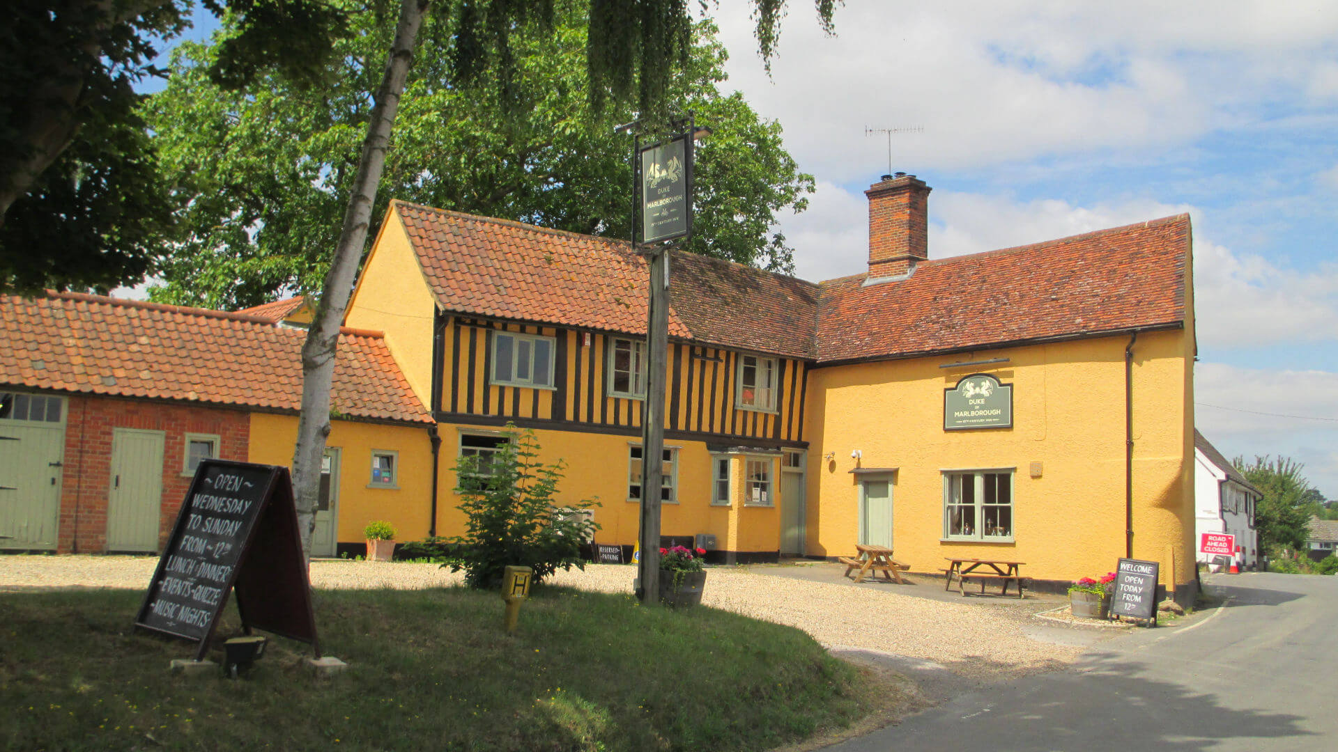
The Duke of Marlborough pub was saved and brought back to life by the local community. Please support them by stopping for a drink or meal.
THE ROUTE
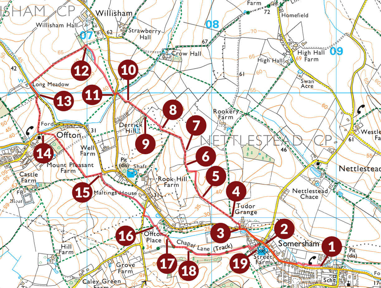
An online version of this map can be found here:
https://osmaps.ordnancesurvey.co.uk/route/3925192/Somersham-v3-080919
PARKING
There is only room for a few cars at the Duke of Marlborough pub.
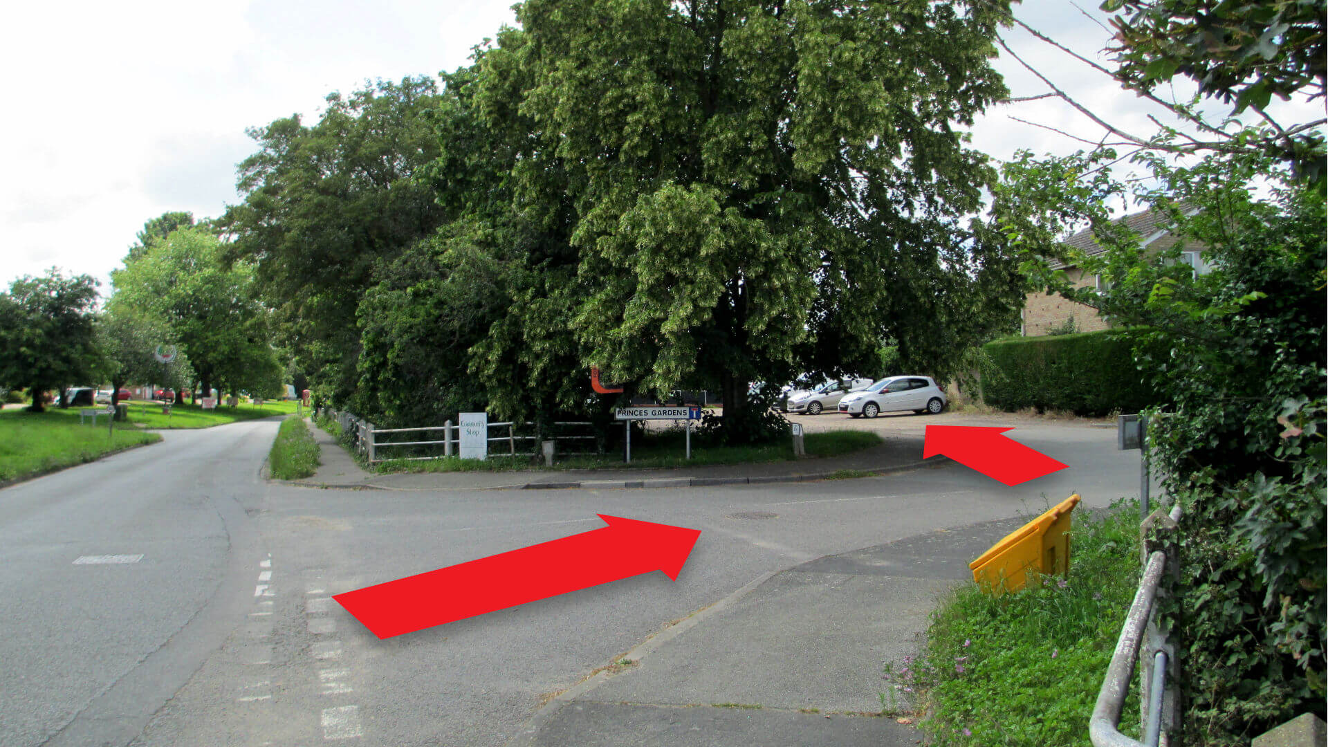
For larger groups, more parking is available next to the community shop (turn into Princes Gardens then left into car park [1] – signed from road). Shop closed Sundays.
Alternatively, there is parking available at the village hall, on the left just before the garage as you enter Somersham from the Ipswich direction.
DIRECTIONS
If starting from the community shop, walk through playing fields, past buildings and sports court, to exit onto the road at the far end. If you have a dog with you, please walk along the road (footpath), as dogs are not allowed on the field. Follow road to pub [2]. Take extra care on short section without pavement.
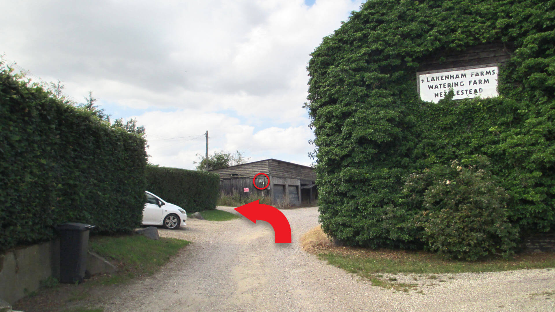
If starting from the Duke of Marlborough, walk up the road (left out of car park, away from Ipswich) 300m to Tudor Grange [3].
Turn right through entrance area then left at footpath sign on barn.
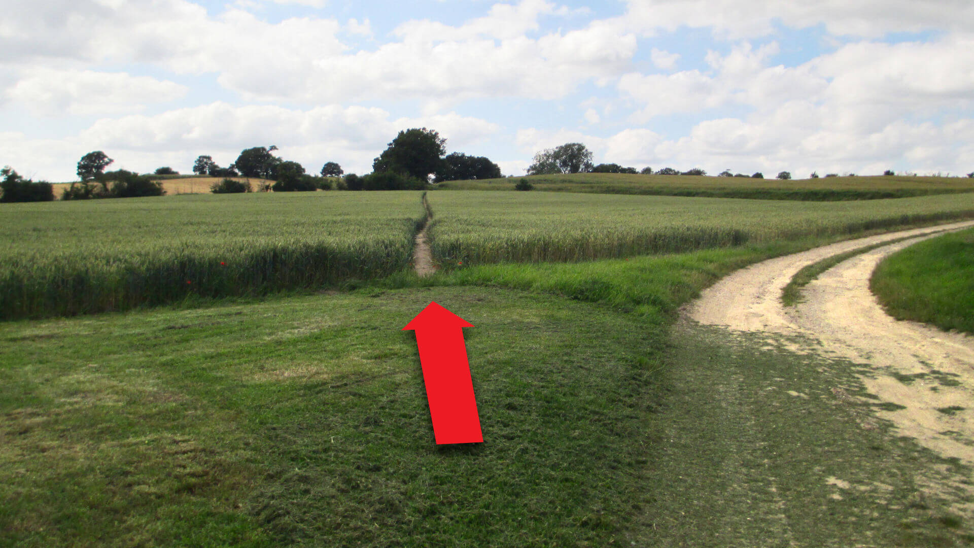
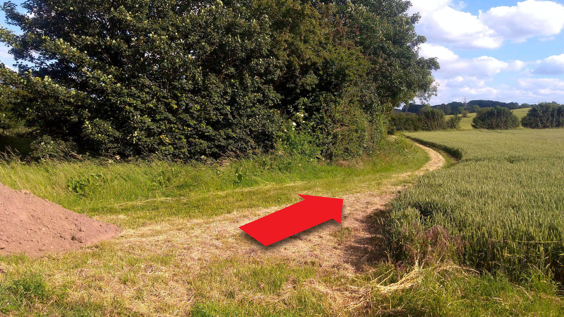
After 100m, take the left path across field [4], follow gently uphill with hedge on left hand side.
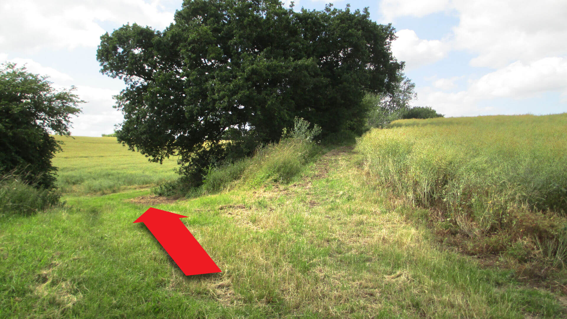
Bear left [5], continue uphill with hedge on right hand side.
Follow the path around the field boundary, then look out for gap through the hedge on the right [6] at the field corner. Go through the gap then continue uphill with the hedge on the left hand side.
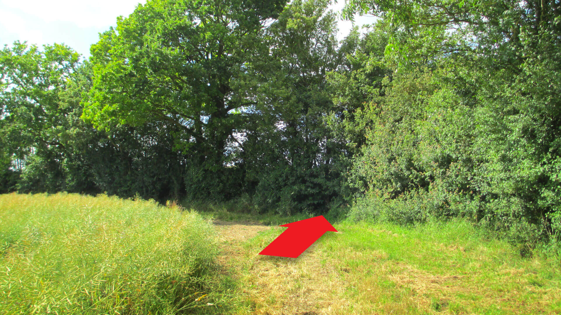
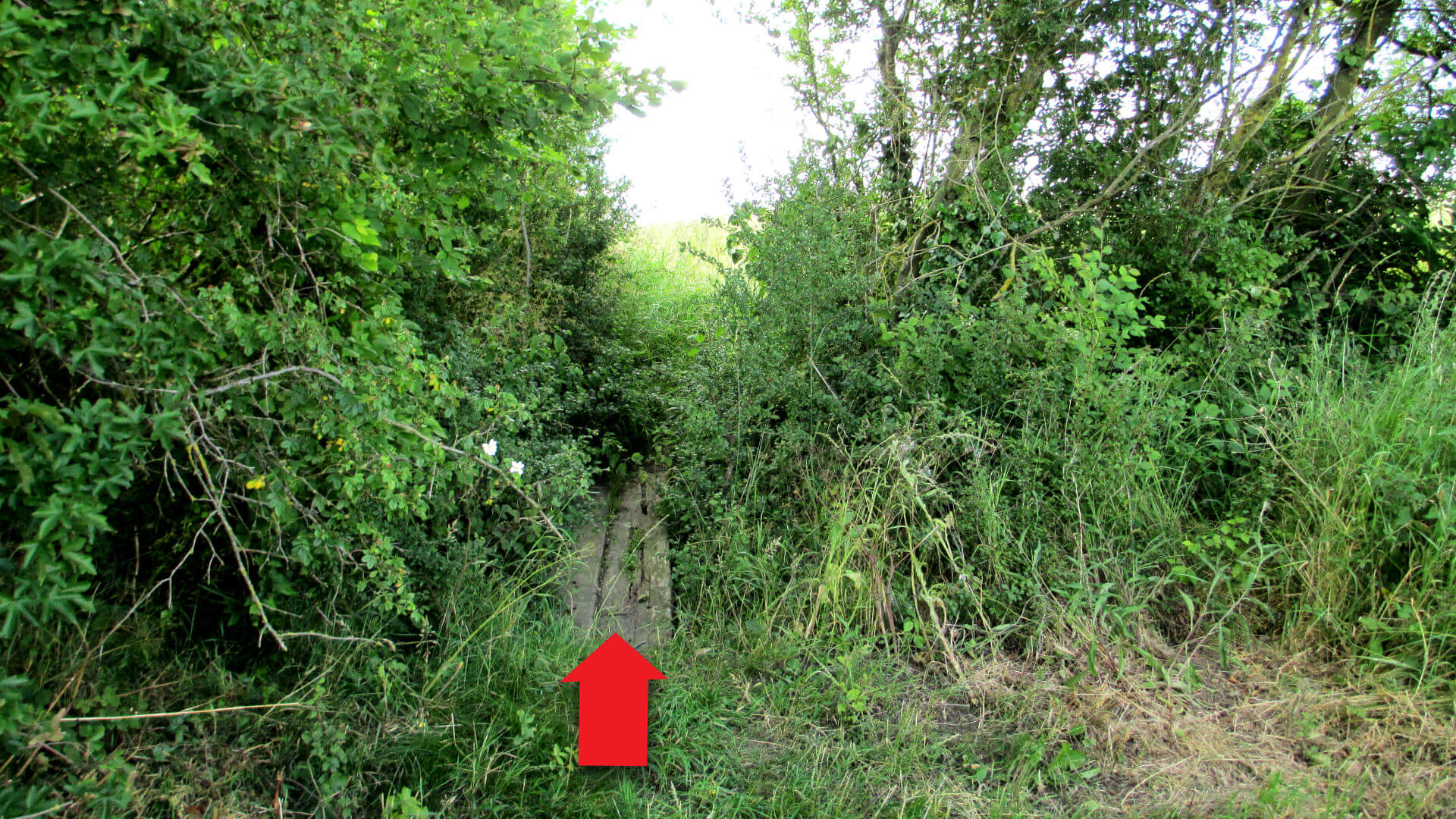
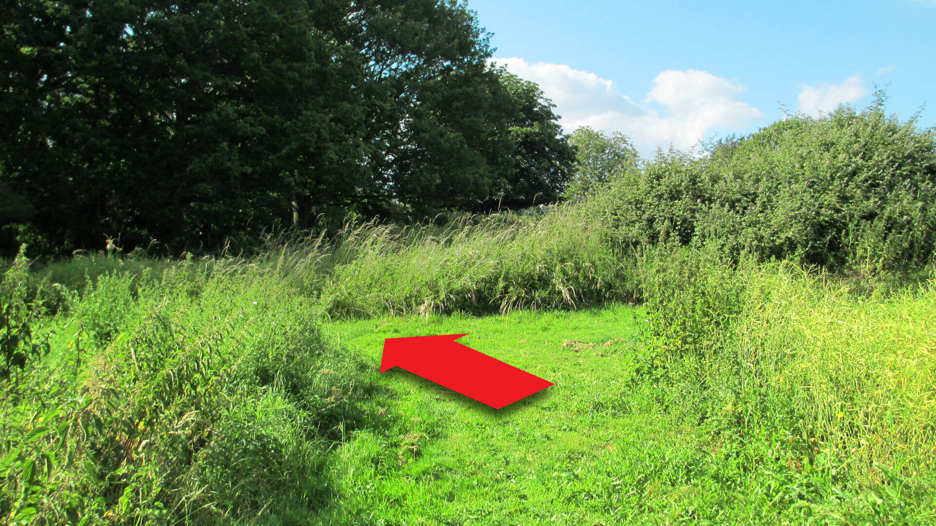
After 150m, where the path turns to the right, turn left through the hedge [7] and continue in a North West direction (hint: if walking in the morning, your shadow will be pointing roughly northwest).
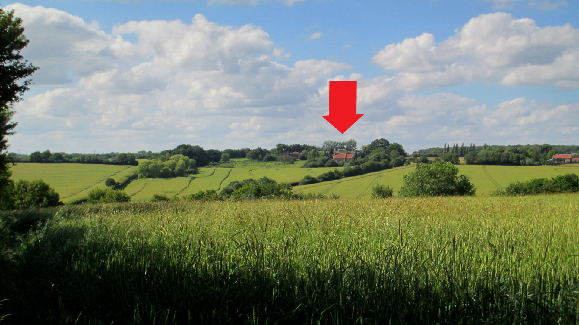
Continue in this same direction, passing through more gaps in hedges [8,9,10], continuing downhill until the view opens out towards Willisham Church [10].
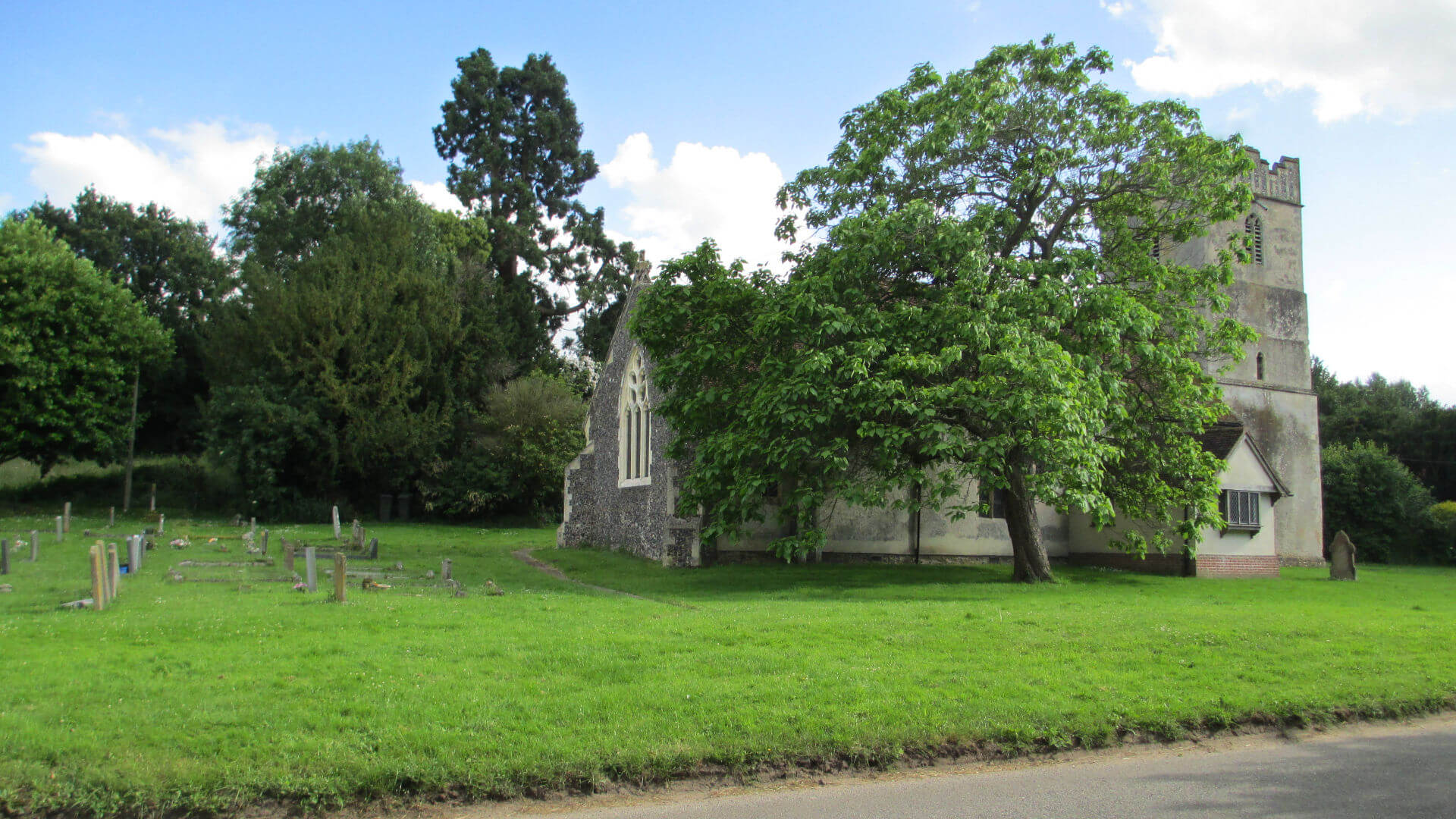
Cross the road to the large concreted area on the left, then take the path uphill [11] towards the Church.

Go past some large weeping trees, until almost at the Church then turn left at the path junction [12] (the church is on the right).
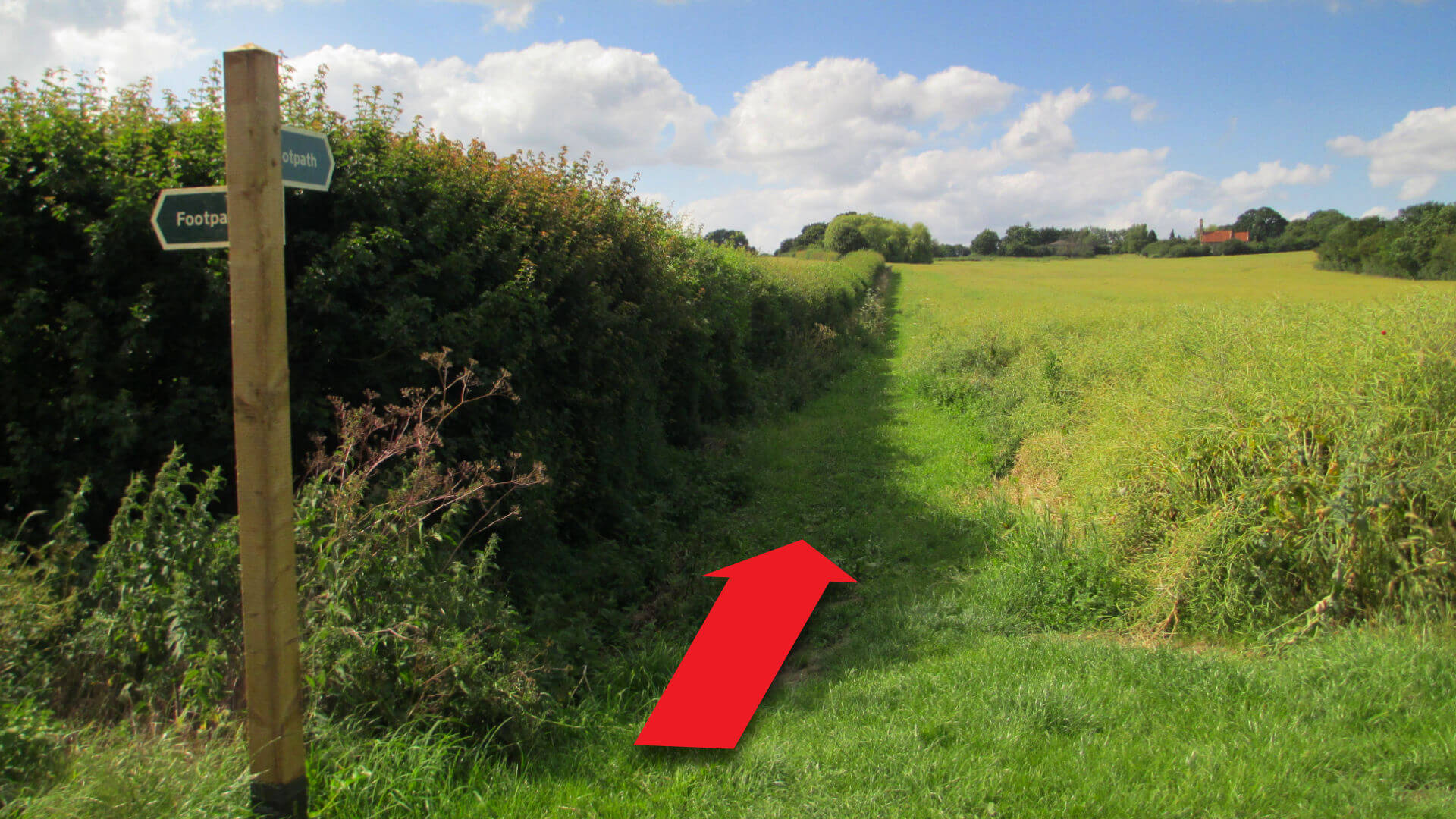
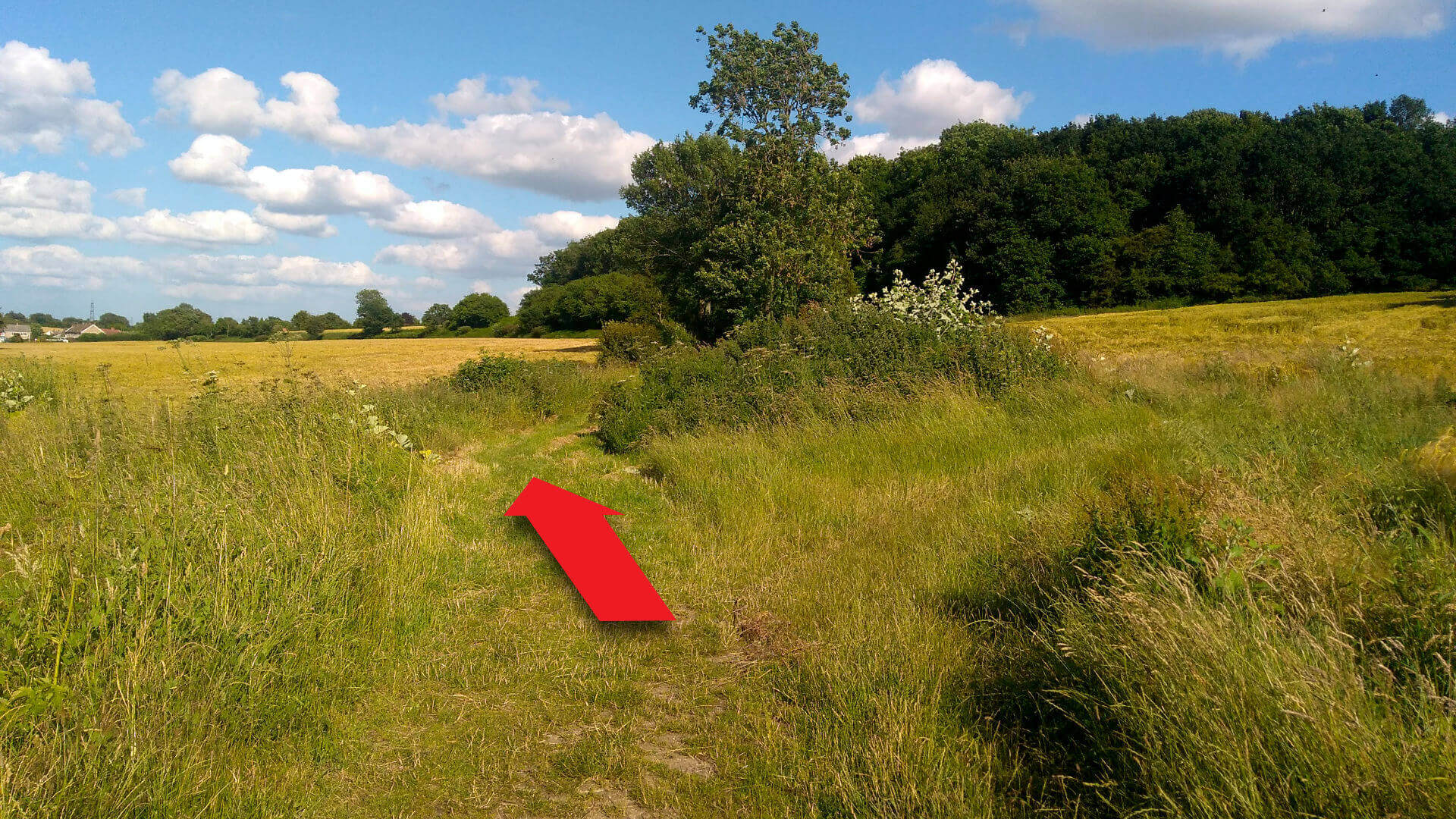
Follow the path across a footbridge then straight on with the hedge on your right hand side. Continue downhill across fields to the road. Turn left on the road for 100m then look out for bridleway and footpath signs to the right [13].
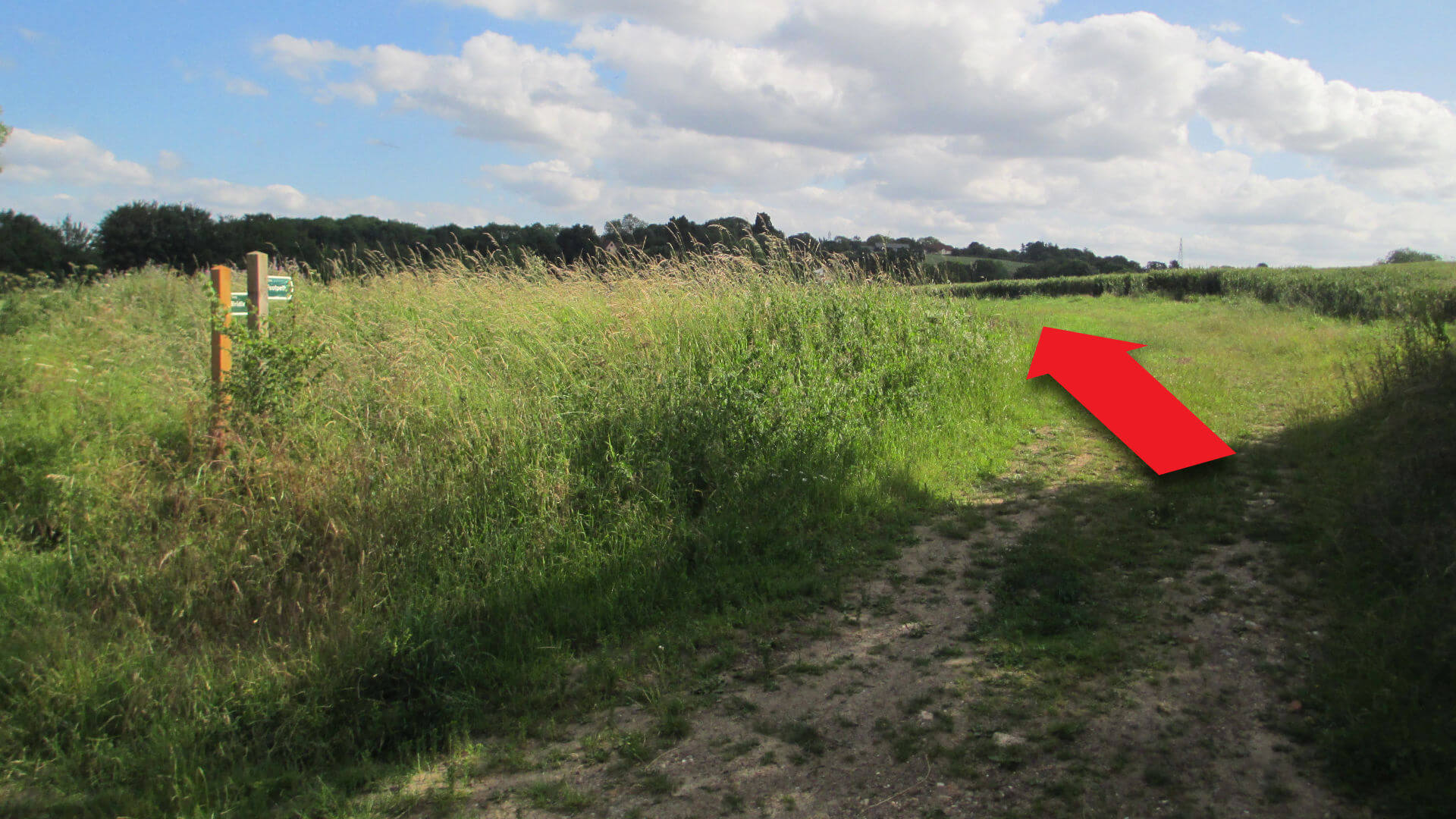
Take the footpath across the field (NOT the bridleway which turns right along the field edge), towards Offton Church (hidden behind trees).
On reaching the concrete ditch crossing, the church can now be seen across the road.
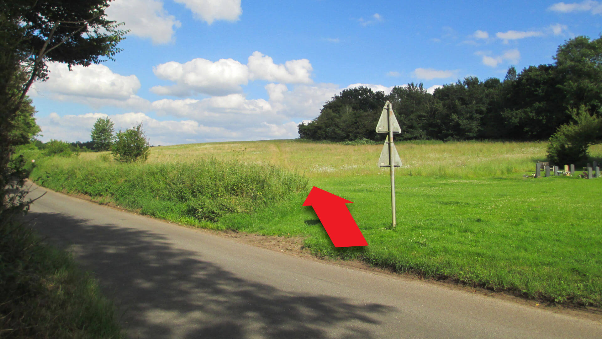
Cross the road then take the path diagonally left across the meadow [14]. Bear right with the hedge on right hand side then continue across field to farm track.
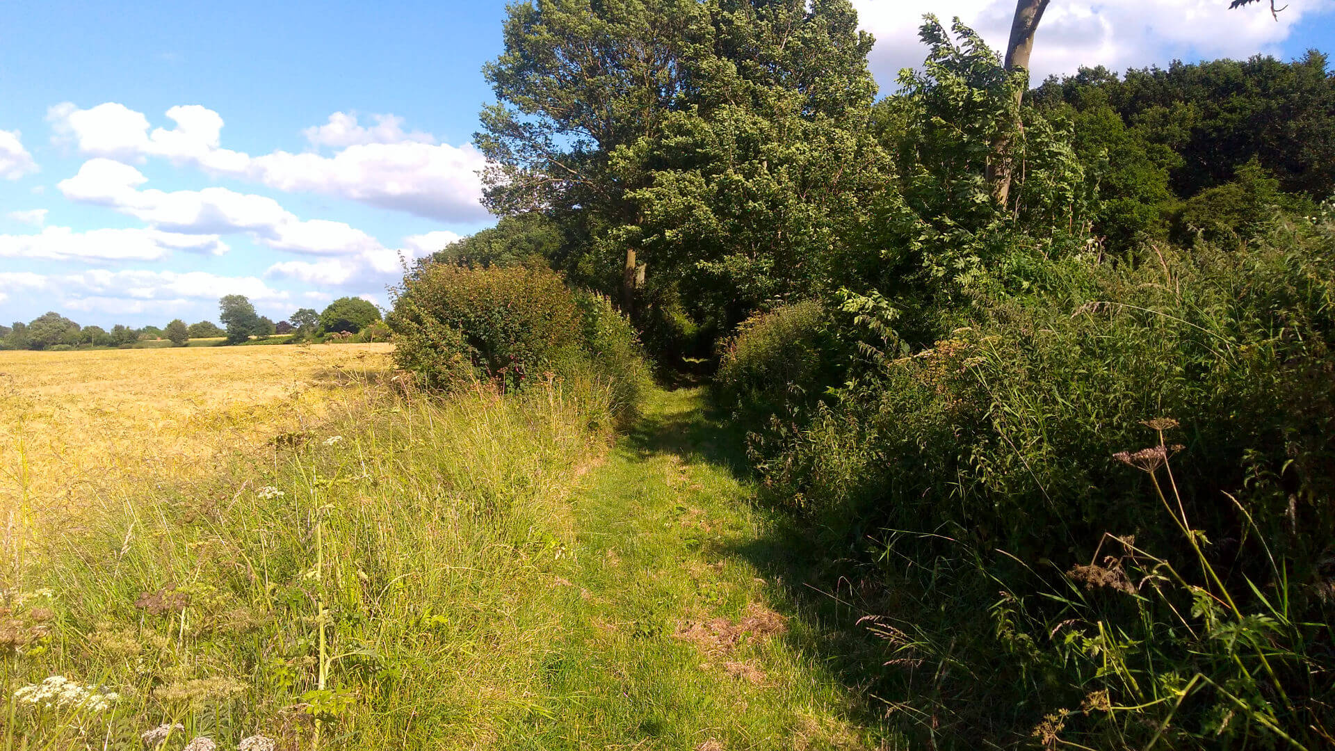
Turn left on the farm track, almost to the road, then take the footpath to the right [15] with ‘The Channel’ on the left hand side. Continue alongside ‘The Channel’, cross a minor road, to the rear of houses at Offton Place.
![]()
![]()
Cross the first footbridge [16]. It looks like someone’s garden (with large cedar tree) but is actually the official footpath. After about 100m, recross ‘The Channel’ using the second footbridge [17] and cross field to green lane ‘Chapel Lane’.
![]()
![]()
If the official path on the other side of The Channel is too overgrown, retreat to the first footbridge and continue on the right hand side of The Channel, bearing right at the second footbridge.
Continue on Chapel Lane [18] to Somersham.
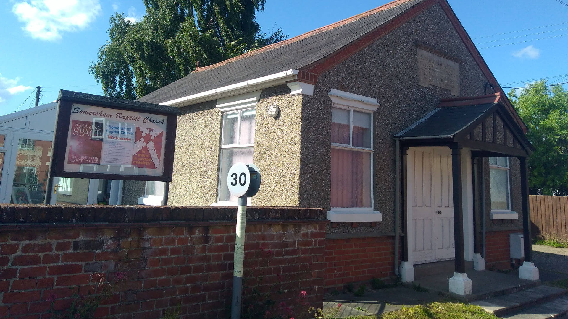
Turns to right then left bring you to buildings [19] with the Chapel on the left and the Duke of Marlborough pub on the right.
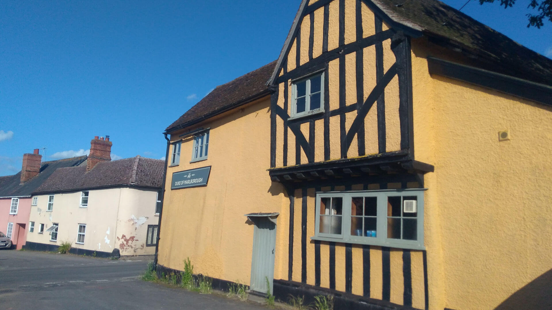
Remember to pop in the pub for a well-earned drink.
Note regarding footpaths: This walk has attempted to follow the official footpaths as far as possible. In some places, fields have been ploughed over and there is an obvious path around the field edge. Therefore the route marked on the map does not always align with the green dotted footpath lines.