Text and pics contributed by Lou
We booked a week in the Lake District just before lockdown easing was announced. Of the several family walks we did, High Street was the highest. Despite it being a linear “there and back” walk, the route very conveniently passed just by where we were staying in Troutbeck and looked on the map to be very straightforward. It was even marked ROMAN ROAD on the OS map, so surely there would be no difficult steep inclines?
We decided to do this walk on the day when the weather was due to change from wet to sunny. We would put up with some rain in the morning in the hope that the clouds would clear in the afternoon to reveal stunning views from the top.
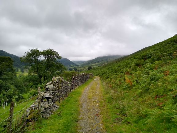

An easy start along a good track 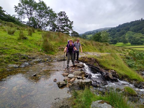
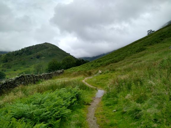
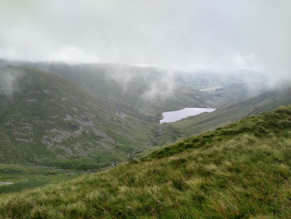
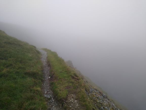
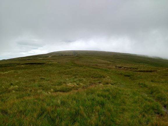
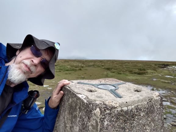
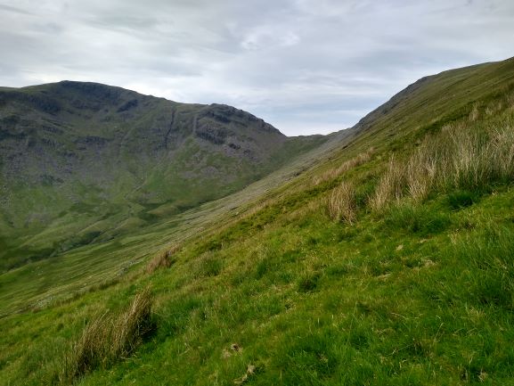
It started very gently, with 3 miles of ambling along a very good track in the valley. Although there was low cloud hanging over the hills, we didn’t have to endure any rain. As we neared the end of the valley, the clouds were still lingering and only part of our route was in view. The good track ended and we started a steep ascent on what could no longer sensibly be described as a road. As we got higher, the cloud engulfed us and we could see neither where we were going nor where we had been. At the top of the Kentmere valley, the most direct route skirted a precipitous drop which swirled with clouds and the occasional view down to the Kentmere Reservoir far below. The clouds started lifting as we walked along the fairly flat summit plateau, also known as Racecourse Hill. No horses were in evidence, although we did meet a shepherd on a quadbike. At the summit trig point I took the usual selfie photo, but instead of stunning views in the background, all was mist and murk.
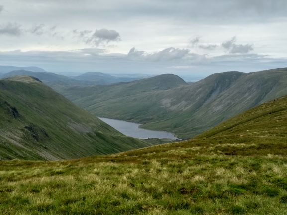
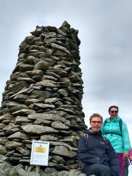
As we sat and ate our tiffin (it has become a tradition in our family to have “tiffin at the top”), the clouds started lifting and we finally got a good view of Hayeswater to the north-west. We made a slight detour on the descent to check out the large cairn atop Thornthwaite Crag, labelled “Beacon” on the OS map. It had a prominent notice warning not to sit near it as it was liable to fall over at any time. I got the kids to sit next to the notice for a photo.
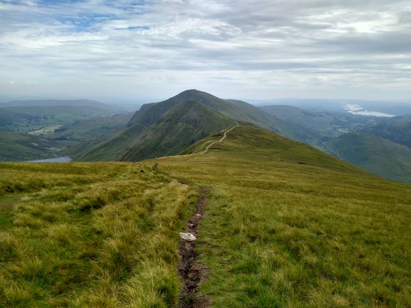

The views really opened up on the way down, with the cliff-like face of Threshthwaite Crag looking rather forbidding. To the west of that is Caudale Moor, where we had made a very chilly ascent to Stony Cove Pike last year. The Kentmere Horseshoe was close by to the East with Ill Bell being the most prominent. I guess it was there on our ascent but I couldn’t see it then.
We saw some sheep being rounded up by a team of shepherds and dogs, bouncing down the steepest part of the slope to the valley below. It looked like they needed shearing.
Once down the steep part, the final 3 miles along the valley was a good cooldown, and once back at our holiday park we stopped at the pub for a well-earned pint or two.
Is it really a Roman Road? http://www.romanroads.org/gazetteer/cumbria/M74.htm
Route Map: https://osmaps.ordnancesurvey.co.uk/route/5711375/High-Street-300720